|
search place name
|
||
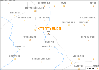
Kytny-Yelga (Bashkortostan, Russia)Kytny-Yelga is a town in the Bashkortostan region of Russia. An overview map of the region around Kytny-Yelga is displayed below.
regional and 3d topo map of Kytny-Yelga, Russia ::
Kytny-Yelga airports ::
The nearest airport is PEE - Perm Bolshoye Savino, located 180.0 km north of Kytny-Yelga.
Other airports nearby include UFA - Ufa (194.8 km south), Nearby towns ::
Tanypovka (3.7km south) //
Starokzyl-Yar (5.6km south) //
Yemash-Pavlovo (3.6km north west) //
Ustinovka (5.7km north) //
Tanyp-Chishma (4.5km south west) //
Novyy Yesaul (5.5km north east) //
[all distances 'as the bird flies' and approximate]  Places with similar names to Kytny-Yelga, Russia ::
// Ketenlik (TR)
// Gooden Lake (US)
// Cotton Lake (US)
// Guatinluca (SV)
// Guidan Léko (NE)
// Kadina Luka (CS)
Disclaimer :: Information on this page comes without warranty of any kind |
||
|
Where is Kytny-Yelga? Elevation and coordinates ::
Latitude (lat): 56°18'0"N Longitude (lon): 56°9'0"E
Elevation (approx.): 143m (map arrows pan, magnifying glasses zoom) |
||
|
Visiting Kytny-Yelga? Hotel/Accommodation ::
Book a hotel in Kytny-Yelga Travel Guide ::
Buy a travel guide for Russia rental cars ::
car rental offers GPS waypoint ::
download a GPX waypoint (PoI) of Kytny-Yelga for your GPS receiver
|
||