|
search place name
|
||
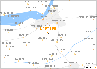
Laptëvo (Nizhegorodskaya Oblast', Russia)Laptëvo is a town in the Nizhegorodskaya Oblast' region of Russia. An overview map of the region around Laptëvo is displayed below.
regional and 3d topo map of Laptëvo, Russia ::
Nearby towns ::
Kalinino (2.7km north) //
Shishkino (2.5km south west) //
Bulatnikovo (3.4km south east) //
Molodëzhnyy (4.5km north) //
Yarymovo (2.9km east) //
Taremskoye (3.5km north west) //
Blizhneye Davydovo (4.9km north) //
Mordovskoye (4.4km south east) //
Pavlovo (6.2km north) //
Sannitsy (8.3km north) //
Bolonino (7.2km south east) //
Bol'shoye Martovo (6.2km south east) //
Maloye Okskoye (8.3km north) //
Leukhovo (8.5km south) //
Bol'shoye Okshoye (8.5km north) //
Amachkino (6.2km south west) //
[all distances 'as the bird flies' and approximate] 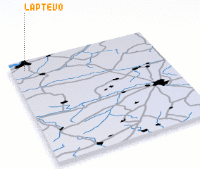 Places with similar names to Laptëvo, Russia ::
Disclaimer :: Information on this page comes without warranty of any kind |
||
|
Where is Laptëvo? Elevation and coordinates ::
Latitude (lat): 55°54'34"N Longitude (lon): 43°5'14"E
Elevation (approx.): 154m (map arrows pan, magnifying glasses zoom) |
||
|
Visiting Laptëvo? Hotel/Accommodation ::
Book a hotel in Laptëvo Travel Guide ::
Buy a travel guide for Russia rental cars ::
car rental offers GPS waypoint ::
download a GPX waypoint (PoI) of Laptëvo for your GPS receiver
|
||