|
search place name
|
||
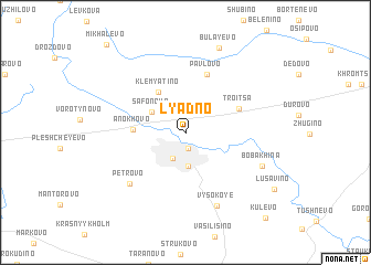
Lyadno (Smolenskaya Oblast', Russia)Lyadno is a town in the Smolenskaya Oblast' region of Russia. An overview map of the region around Lyadno is displayed below.
regional and 3d topo map of Lyadno, Russia ::
Lyadno airports ::
The nearest airport is BZK - Bryansk, located 221.8 km south of Lyadno.
Nearby towns ::
Dorogobuzh (1.6km south) //
Safonovo (2.8km south) //
Borisova (3.5km south) //
Safonovo (2.9km north west) //
Klemyatino (4.4km north) //
Anokhovo (3.0km west) //
Troitsa (3.9km north east) //
Pavlovo (5.9km north) //
Petrovo (6.1km south west) //
Vysokoye (7.7km south) //
Bobakhina (5.6km south east) //
Bulayevo (8.8km north) //
Kulëvo (9.8km south east) //
Mikhalëvo (9.9km north west) //
[all distances 'as the bird flies' and approximate]  Places with similar names to Lyadno, Russia ::
// Lyatno (BG)
// Lyadina (RU)
// Lyadiny (RU)
// Lyadiny (RU)
// Lyadiny (RU)
// Lyadiny (RU)
// Lyutin (RU)
// Lyudynʼ (UA)
// Li-yü-t'an (TW)
// Li-yü-t'an (TW)
Disclaimer :: Information on this page comes without warranty of any kind |
||
|
Where is Lyadno? Elevation and coordinates ::
Latitude (lat): 55°7'52"N Longitude (lon): 33°14'50"E
Elevation (approx.): 201m (map arrows pan, magnifying glasses zoom) |
||
|
Visiting Lyadno? Hotel/Accommodation ::
Book a hotel in Lyadno Travel Guide ::
Buy a travel guide for Russia rental cars ::
car rental offers GPS waypoint ::
download a GPX waypoint (PoI) of Lyadno for your GPS receiver
|
||