|
search place name
|
||
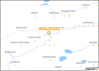
Maklochek (Novgorodskaya Oblast', Russia)Maklochek is a town in the Novgorodskaya Oblast' region of Russia. An overview map of the region around Maklochek is displayed below.
regional and 3d topo map of Maklochek, Russia ::
Nearby towns ::
Olëshino (0.0km north) //
Pereyezd (1.6km south) //
Rzhanyye Rogi (1.0km west) //
Lesha (1.9km south) //
Novaya Zhuravka (3.7km south) //
Kstechki (3.4km south) //
Shakhova (2.7km north east) //
Staraya Zhuravka (3.8km south) //
Ryabyye Rogi (3.5km south west) //
Novoye Yablonovo (3.5km south west) //
Vashkova (7.5km north) //
Maloye Vakhromeyevo (8.0km north) //
Adrino (8.0km north) //
Bol'shoye Vakhromeyevo (8.4km north east) //
Vakhromeyevo (9.0km north east) //
[all distances 'as the bird flies' and approximate] 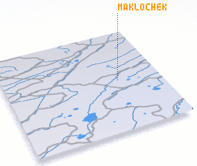 Places with similar names to Maklochek, Russia ::
// Miguel Choco (PT)
Disclaimer :: Information on this page comes without warranty of any kind |
||
|
Where is Maklochek? Elevation and coordinates ::
Latitude (lat): 57°31'0"N Longitude (lon): 30°44'0"E
Elevation (approx.): 81m (map arrows pan, magnifying glasses zoom) |
||
|
Visiting Maklochek? Hotel/Accommodation ::
Book a hotel in Maklochek Travel Guide ::
Buy a travel guide for Russia rental cars ::
car rental offers GPS waypoint ::
download a GPX waypoint (PoI) of Maklochek for your GPS receiver
|
||