|
search place name
|
||
Ogorovasta (Pskovskaya Oblast', Russia)Ogorovasta is a town in the Pskovskaya Oblast' region of Russia. An overview map of the region around Ogorovasta is displayed below.
regional and 3d topo map of Ogorovasta, Russia ::

Ogorovasta airports ::
The nearest airport is LED - St. Petersburg Pulkovo, located 221.0 km north of Ogorovasta.
Nearby towns ::
Borisikha (1.8km east) //
Kolyanitsa (4.0km north) //
Mikhaylov Pogost (3.0km north west) //
Fedorkovo (5.6km north) //
Krivukha (6.3km north) //
Dolgusha (7.5km south) //
Korpovo (6.3km north east) //
Krutets (7.7km south) //
Sorokino (6.2km north west) //
Bol'shoy Lug (8.0km south) //
Malyy Lug (8.4km south west) //
Yukovo (8.4km south east) //
Lyuta (8.2km north west) //
Morino (9.3km north east) //
[all distances 'as the bird flies' and approximate] 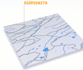 Places with similar names to Ogorovasta, Russia :: Disclaimer :: Information on this page comes without warranty of any kind |
||
|
Where is Ogorovasta? Elevation and coordinates ::
Latitude (lat): 57°49'0"N Longitude (lon): 30°18'0"E
Elevation (approx.): 85m (map arrows pan, magnifying glasses zoom) |
||
|
Visiting Ogorovasta? Hotel/Accommodation ::
Book a hotel in Ogorovasta Travel Guide ::
Buy a travel guide for Russia rental cars ::
car rental offers GPS waypoint ::
download a GPX waypoint (PoI) of Ogorovasta for your GPS receiver
|
||