|
search place name
|
||
Otturitsy (Novgorodskaya Oblast', Russia)Otturitsy is a town in the Novgorodskaya Oblast' region of Russia. An overview map of the region around Otturitsy is displayed below.
regional and 3d topo map of Otturitsy, Russia ::

Otturitsy airports ::
The nearest airport is LED - St. Petersburg Pulkovo, located 147.2 km north of Otturitsy.
Nearby towns ::
Tanina Gora (1.9km south) //
Radovezhi (1.0km east) //
Lyubino Pole (1.0km west) //
Kositskoye (1.0km west) //
Doskino (2.7km south east) //
Smych (2.7km north east) //
Kholmino (5.6km south) //
Tolchino (5.9km south) //
Goritsy (4.7km north west) //
Ostrov (3.9km east) //
Zhiloy Berezhok (3.9km west) //
Glukhoy Berezhok (3.9km west) //
Pokrovka (4.3km north east) //
Kupchaya (7.5km north) //
Kleshno (5.4km north east) //
Budyni (7.7km north) //
Pinega (7.7km north) //
Zakamenka (5.4km north west) //
Zharki (8.0km north) //
Izbishche (6.8km north west) //
[all distances 'as the bird flies' and approximate] 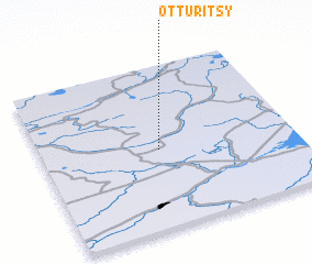
Disclaimer :: Information on this page comes without warranty of any kind |
||
|
Where is Otturitsy? Elevation and coordinates ::
Latitude (lat): 58°29'0"N Longitude (lon): 30°28'0"E
Elevation (approx.): 43m (map arrows pan, magnifying glasses zoom) |
||
|
Visiting Otturitsy? Hotel/Accommodation ::
Book a hotel in Otturitsy Travel Guide ::
Buy a travel guide for Russia rental cars ::
car rental offers GPS waypoint ::
download a GPX waypoint (PoI) of Otturitsy for your GPS receiver
|
||