|
search place name
|
||
Poluyanovo (Tverskaya Oblast', Russia)Poluyanovo is a town in the Tverskaya Oblast' region of Russia. An overview map of the region around Poluyanovo is displayed below.
regional and 3d topo map of Poluyanovo, Russia ::

Poluyanovo airports ::
The nearest airport is VTB - Vitebsk, located 203.8 km south of Poluyanovo.
Nearby towns ::
Kozlovo (4.2km south east) //
Baranosovo (3.0km west) //
Snopovo (3.0km west) //
Abramovo (3.0km west) //
Rovnovo (5.6km north) //
Stolopno (3.6km south east) //
Gorevitsy (3.6km north west) //
Zakholom'ye (5.7km south) //
Rogozino (5.9km south) //
Malyy Klin (4.5km north east) //
Stikhovo (6.3km north west) //
Gorshok (6.3km north west) //
[all distances 'as the bird flies' and approximate] 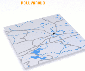 Places with similar names to Poluyanovo, Russia ::
// Polyanovo (BG)
// Polyanovo (BG)
// Playa Nueva (CO)
// Playa Nueva (VE)
// Poluyanovo (RU)
// Poluyanovo (RU)
// Poluyanovo (RU)
// Pol'yanovo (RU)
// Pol'yanovo (RU)
// Poluyanovo (BY)
Disclaimer :: Information on this page comes without warranty of any kind |
||
|
Where is Poluyanovo? Elevation and coordinates ::
Latitude (lat): 56°53'0"N Longitude (lon): 31°16'0"E
Elevation (approx.): 154m (map arrows pan, magnifying glasses zoom) |
||
|
Visiting Poluyanovo? Hotel/Accommodation ::
Book a hotel in Poluyanovo Travel Guide ::
Buy a travel guide for Russia rental cars ::
car rental offers GPS waypoint ::
download a GPX waypoint (PoI) of Poluyanovo for your GPS receiver
|
||