|
search place name
|
||
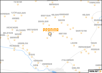
Pronina (Komi-Permyatskiy Avtonomnyy Okrug, Russia)Pronina is a town in the Komi-Permyatskiy Avtonomnyy Okrug region of Russia. An overview map of the region around Pronina is displayed below.
regional and 3d topo map of Pronina, Russia ::
Pronina airports ::
The nearest airport is PEE - Perm Bolshoye Savino, located 158.3 km south east of Pronina.
Nearby towns ::
Yagodina (0.9km south west) //
Dmitriyevka (1.7km north) //
Tereneva (2.2km north) //
Gabova (4.1km north) //
Martina (2.2km east) //
Gavrilova (4.9km north) //
Alekova (3.1km east) //
Savina (5.4km north) //
Aref'yeva (6.8km north) //
Vasyukova (3.9km north west) //
Molova (7.1km north) //
Zherebtsova (5.3km north east) //
Yermakova (4.5km north east) //
Murmarova (4.0km east) //
Kamashor (7.6km north) //
Mizhuyeva (5.2km north east) //
Levina (5.5km south east) //
Mosheva (7.3km south west) //
Kordyukova (6.7km south west) //
Otevo (8.3km south west) //
[all distances 'as the bird flies' and approximate] 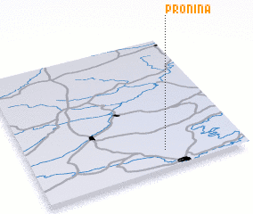 Places with similar names to Pronina, Russia ::
Disclaimer :: Information on this page comes without warranty of any kind |
||
|
Where is Pronina? Elevation and coordinates ::
Latitude (lat): 59°8'11"N Longitude (lon): 54°38'0"E
Elevation (approx.): 154m (map arrows pan, magnifying glasses zoom) |
||
|
Visiting Pronina? Hotel/Accommodation ::
Book a hotel in Pronina Travel Guide ::
Buy a travel guide for Russia rental cars ::
car rental offers GPS waypoint ::
download a GPX waypoint (PoI) of Pronina for your GPS receiver
|
||