|
search place name
|
||
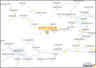
Runtseva (Komi-Permyatskiy Avtonomnyy Okrug, Russia)Runtseva is a town in the Komi-Permyatskiy Avtonomnyy Okrug region of Russia. An overview map of the region around Runtseva is displayed below.
regional and 3d topo map of Runtseva, Russia ::
Runtseva airports ::
The nearest airport is PEE - Perm Bolshoye Savino, located 149.3 km south east of Runtseva.
Nearby towns ::
Chashilova (0.9km north west) //
Pors'kokovo (1.7km north west) //
Proneva (1.4km north east) //
(( Levin-Ivan )) (1.5km west) //
Yegva (3.1km north) //
Levina (4.0km north west) //
Systerova (3.3km east) //
Kharina (5.6km south) //
Bol'shaya Serva (5.1km south west) //
Malaya Serva (7.0km south) //
Lopatina (7.1km south) //
Chalina (6.7km south) //
Shipitsyna (7.6km north) //
Murmarova (6.2km north west) //
Zyul'ganova (5.1km south west) //
Kozlova (7.3km north) //
Batina (4.8km east) //
Chakileva (7.7km south east) //
Alekova (7.2km north west) //
[all distances 'as the bird flies' and approximate] 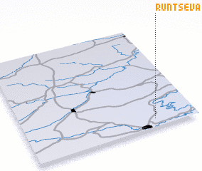
Disclaimer :: Information on this page comes without warranty of any kind |
||
|
Where is Runtseva? Elevation and coordinates ::
Latitude (lat): 59°4'49"N Longitude (lon): 54°45'29"E
Elevation (approx.): 170m (map arrows pan, magnifying glasses zoom) |
||
|
Visiting Runtseva? Hotel/Accommodation ::
Book a hotel in Runtseva Travel Guide ::
Buy a travel guide for Russia rental cars ::
car rental offers GPS waypoint ::
download a GPX waypoint (PoI) of Runtseva for your GPS receiver
|
||