|
search place name
|
||
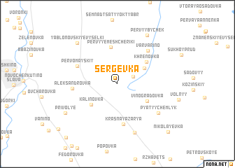
Sergëvka (Lipetskaya Oblast', Russia)Sergëvka is a town in the Lipetskaya Oblast' region of Russia. An overview map of the region around Sergëvka is displayed below.
regional and 3d topo map of Sergëvka, Russia ::
Sergëvka airports ::
The nearest airport is VOZ - Voronezh Chertovitskoye, located 104.4 km south west of Sergëvka.
Nearby towns ::
Somovka (1.9km north east) //
Vtoryye Meshcheriki (3.3km north west) //
Ploskoye (3.6km north east) //
Kalinovka (4.2km south west) //
Vinogradovka (4.0km south east) //
Khrenovka (4.5km north east) //
Pervyye Meshcheriki (5.9km north) //
Krasnaya Zarya (6.5km south) //
Pervomayskiy (4.8km north west) //
Varvarino (6.0km north east) //
Aleksandrovka (4.4km west) //
Pyatyy Chemlyk (6.1km south east) //
Sredneye (8.0km south) //
Pervyy Bychëk (8.3km north) //
Yablonovskiye Vyselki (7.6km north west) //
Privol'ye (6.8km south west) //
Petrovka (6.8km south west) //
Nikolayevka (9.1km south east) //
Pavlovka (9.9km south west) //
[all distances 'as the bird flies' and approximate] 
Disclaimer :: Information on this page comes without warranty of any kind |
||
|
Where is Sergëvka? Elevation and coordinates ::
Latitude (lat): 52°18'29"N Longitude (lon): 40°31'28"E
Elevation (approx.): 148m (map arrows pan, magnifying glasses zoom) |
||
|
Visiting Sergëvka? Hotel/Accommodation ::
Book a hotel in Sergëvka Travel Guide ::
Buy a travel guide for Russia rental cars ::
car rental offers GPS waypoint ::
download a GPX waypoint (PoI) of Sergëvka for your GPS receiver
|
||