|
search place name
|
||
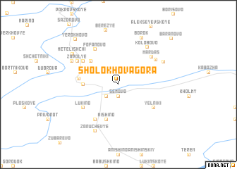
Sholokhova Gora (Vologodskaya Oblast', Russia)Sholokhova Gora is a town in the Vologodskaya Oblast' region of Russia. An overview map of the region around Sholokhova Gora is displayed below.
regional and 3d topo map of Sholokhova Gora, Russia ::
Nearby towns ::
Sëmovo (1.9km south) //
Trukhino (2.1km south west) //
Izboishchi (2.1km south west) //
Selekhovo (2.9km west) //
Zagor'ye (4.3km north west) //
Mishino (5.6km south) //
Kharchikha (3.4km west) //
Fofanovo (5.9km north) //
Gorochka (5.9km south) //
Lukino (4.7km south west) //
Lyubakhina (4.7km north west) //
Yel'niki (4.7km south east) //
Mardas (5.1km north east) //
Kostylëva Gora (5.0km north east) //
Kolobovo (6.3km north) //
Zapol'ye (5.0km north west) //
Trukhnovo (5.2km north east) //
Zaruchev'ye (7.7km south) //
Makar'ino (5.3km north west) //
Borok (7.7km north) //
Metelishchi (6.1km north west) //
Berez'ye (8.6km north) //
Yerokhovo (7.9km north west) //
Baranovo (8.4km north east) //
[all distances 'as the bird flies' and approximate] 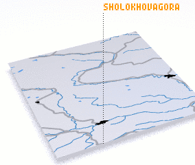 Places with similar names to Sholokhova Gora, Russia :: Disclaimer :: Information on this page comes without warranty of any kind |
||
|
Where is Sholokhova Gora? Elevation and coordinates ::
Latitude (lat): 59°0'0"N Longitude (lon): 35°18'0"E
Elevation (approx.): 140m (map arrows pan, magnifying glasses zoom) |
||
|
Visiting Sholokhova Gora? Hotel/Accommodation ::
Book a hotel in Sholokhova Gora Travel Guide ::
Buy a travel guide for Russia rental cars ::
car rental offers GPS waypoint ::
download a GPX waypoint (PoI) of Sholokhova Gora for your GPS receiver
|
||