|
search place name
|
||
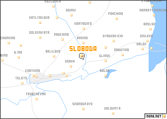
Sloboda (Bryanskaya Oblast', Russia)Sloboda is a town in the Bryanskaya Oblast' region of Russia. An overview map of the region around Sloboda is displayed below.
regional and 3d topo map of Sloboda, Russia ::
Sloboda airports ::
The nearest airport is BZK - Bryansk, located 69.7 km north of Sloboda.
Nearby towns ::
Radiisk (2.4km north west) //
Usokh (2.2km south west) //
Annino (3.8km north) //
Glinsk (3.1km east) //
Verkhniye Gorodtsy (4.3km south west) //
Peredniye Gorodtsy (4.1km south west) //
Subbotovo (4.0km north east) //
Sol'ka (4.8km south east) //
Radchino (5.4km north west) //
Belilovo (4.1km west) //
Komyagino (7.0km north) //
Dyad'kovichi (5.8km north east) //
Sredniye Gorodtsy (5.8km south west) //
Radutino (5.4km east) //
[all distances 'as the bird flies' and approximate] 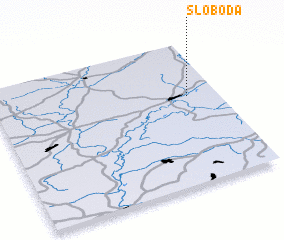 Places with similar names to Sloboda, Russia ::
Disclaimer :: Information on this page comes without warranty of any kind |
||
|
Where is Sloboda? Elevation and coordinates ::
Latitude (lat): 52°36'58"N Longitude (lon): 33°52'3"E
Elevation (approx.): 150m (map arrows pan, magnifying glasses zoom) |
||
|
Visiting Sloboda? Hotel/Accommodation ::
Book a hotel in Sloboda Travel Guide ::
Buy a travel guide for Russia rental cars ::
car rental offers GPS waypoint ::
download a GPX waypoint (PoI) of Sloboda for your GPS receiver
|
||