|
search place name
|
||
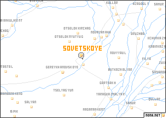
Sovetskoye (Dagestan, Russia)Sovetskoye is a town in the Dagestan region of Russia. An overview map of the region around Sovetskoye is displayed below.
regional and 3d topo map of Sovetskoye, Russia ::
Sovetskoye airports ::
The nearest airport is MCX - Makhachkala Uytash, located 132.8 km north west of Sovetskoye.
Other airports nearby include BAK - Baku Heydar Aliyev (201.4 km south east), Nearby towns ::
(( Khandzhalkala )) (1.2km south) //
Otsëlok Nyutyug (4.6km north west) //
Alamishe (5.0km north east) //
Gereykhanovskoye (4.5km south west) //
Tselyagyun-Kazmalyar (4.7km south west) //
Otsëlok Kirchag (5.9km north) //
Novaya Maka (5.9km north east) //
Chukhverkent (6.6km north east) //
Novyy Aul (6.0km east) //
Gaptsakh (7.8km south east) //
Butkazmalyar (7.3km south east) //
Tselyagyun (8.8km south) //
Darkushkazmalyar (10.6km north east) //
[all distances 'as the bird flies' and approximate] 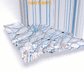 Places with similar names to Sovetskoye, Russia ::
// Suvodskaya (RU)
// Zavodskaya (RU)
// Zavodskaya (RU)
// Zavodskaya (RU)
// Zavodskoye (RU)
// Zavodskoye (RU)
// Zavodskoye (RU)
// Zavodskoye (RU)
// Sovetskoye (UA)
// Sovetskoye (UA)
Disclaimer :: Information on this page comes without warranty of any kind |
||
|
Where is Sovetskoye? Elevation and coordinates ::
Latitude (lat): 41°43'52"N Longitude (lon): 48°19'39"E
Elevation (approx.): 231m (map arrows pan, magnifying glasses zoom) |
||
|
Visiting Sovetskoye? Hotel/Accommodation ::
Book a hotel in Sovetskoye Travel Guide ::
Buy a travel guide for Russia rental cars ::
car rental offers GPS waypoint ::
download a GPX waypoint (PoI) of Sovetskoye for your GPS receiver
|
||