|
search place name
|
||
Stepanovskiy (Orenburgskaya Oblast', Russia)Stepanovskiy is a town in the Orenburgskaya Oblast' region of Russia. An overview map of the region around Stepanovskiy is displayed below.
regional and 3d topo map of Stepanovskiy, Russia ::
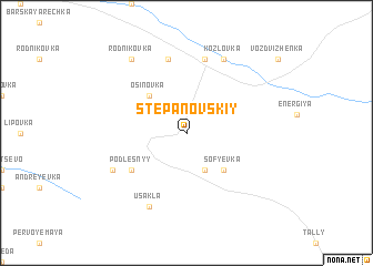
Nearby towns ::
Chibrikovka (3.9km south) //
Sof'yevka (4.3km south east) //
Krasnogorskiy (4.3km north west) //
Osinovka (4.3km north west) //
Podlesnyy (5.0km south west) //
Vladimiro-Nikol'skoye (7.5km north) //
Zaporozhets (7.5km north) //
Nogino-Vashevo (7.5km north) //
Usakla (7.7km south) //
Kozlovka (7.7km north) //
Fëdorovskiy (5.8km south west) //
Rodnikovka (8.1km north west) //
[all distances 'as the bird flies' and approximate]  Places with similar names to Stepanovskiy, Russia ::
// Stepanovskiy (RU)
// Stepanovskiy (RU)
// Stepanovskiy (RU)
// Stepanovskiy (RU)
// Stepnovskiy (RU)
// Štěpánovsko (CZ)
Disclaimer :: Information on this page comes without warranty of any kind |
||
|
Where is Stepanovskiy? Elevation and coordinates ::
Latitude (lat): 53°14'0"N Longitude (lon): 52°57'0"E
Elevation (approx.): 197m (map arrows pan, magnifying glasses zoom) |
||
|
Visiting Stepanovskiy? Hotel/Accommodation ::
Book a hotel in Stepanovskiy Travel Guide ::
Buy a travel guide for Russia rental cars ::
car rental offers GPS waypoint ::
download a GPX waypoint (PoI) of Stepanovskiy for your GPS receiver
|
||