|
search place name
|
||
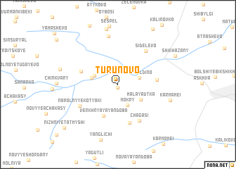
Turunovo (Chuvashiya, Russia)Turunovo is a town in the Chuvashiya region of Russia. An overview map of the region around Turunovo is displayed below.
regional and 3d topo map of Turunovo, Russia ::
Turunovo airports ::
The nearest airport is KZN - Kazan, located 124.1 km east of Turunovo.
Nearby towns ::
Nizhniye Yandoby (0.5km south) //
Baygil'dino (2.2km north east) //
Mokry (3.4km south) //
Novaya Zhizn' (2.5km north west) //
Malaya Utka (3.1km south east) //
Novyye Chelkasy (2.6km north west) //
Verkhnyaya Yandoba (5.2km south) //
Maloye Tugayevo (3.9km north west) //
Novyye Mamei (3.6km east) //
Utkino (6.1km south) //
Chagasi (6.1km south) //
Sidelevo (5.8km north east) //
Napol'nyye Kotyaki (4.9km south west) //
Maldykasy (7.7km north) //
Karmamei (5.3km south east) //
Kazakkasy (8.8km north) //
Yanglichi (8.9km south) //
Novyye Lapry (9.3km north) //
Nizhniye Tatmyshi (8.4km south west) //
[all distances 'as the bird flies' and approximate]  Places with similar names to Turunovo, Russia ::
Disclaimer :: Information on this page comes without warranty of any kind |
||
|
Where is Turunovo? Elevation and coordinates ::
Latitude (lat): 55°31'16"N Longitude (lon): 47°19'1"E
Elevation (approx.): 94m (map arrows pan, magnifying glasses zoom) |
||
|
Visiting Turunovo? Hotel/Accommodation ::
Book a hotel in Turunovo Travel Guide ::
Buy a travel guide for Russia rental cars ::
car rental offers GPS waypoint ::
download a GPX waypoint (PoI) of Turunovo for your GPS receiver
|
||