|
search place name
|
||
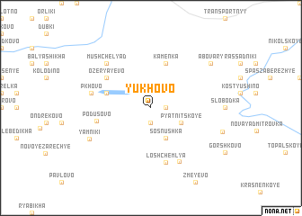
Yukhovo (Tverskaya Oblast', Russia)Yukhovo is a town in the Tverskaya Oblast' region of Russia. An overview map of the region around Yukhovo is displayed below.
regional and 3d topo map of Yukhovo, Russia ::
Yukhovo airports ::
The nearest airport is KLD - Tver Migalovo, located 133.2 km south of Yukhovo.
Nearby towns ::
Afanasovo (1.9km south) //
Malan'ino (1.0km east) //
Sosnushka (3.8km south) //
Pyatnitskoye (2.7km south east) //
Staro-Pkhovo (3.5km north west) //
Glebezdovo (3.5km north west) //
Kamenka (5.6km north) //
Ozeryayevo (4.7km north west) //
Podusovo (3.9km south west) //
Loshchemlya (6.9km south) //
Yermolino (6.9km south) //
Pkhovo (4.3km north west) //
Mushchelyad' (6.3km north west) //
Yamniki (5.5km south west) //
Abovary (6.8km north east) //
Stolopovo (5.6km south east) //
[all distances 'as the bird flies' and approximate] 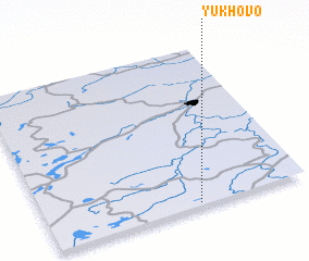
Disclaimer :: Information on this page comes without warranty of any kind |
||
|
Where is Yukhovo? Elevation and coordinates ::
Latitude (lat): 58°1'0"N Longitude (lon): 35°35'0"E
Elevation (approx.): 142m (map arrows pan, magnifying glasses zoom) |
||
|
Visiting Yukhovo? Hotel/Accommodation ::
Book a hotel in Yukhovo Travel Guide ::
Buy a travel guide for Russia rental cars ::
car rental offers GPS waypoint ::
download a GPX waypoint (PoI) of Yukhovo for your GPS receiver
|
||