|
search place name
|
||
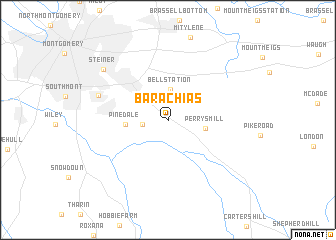
Barachias (Alabama, United States - USA)Barachias is a town in the Alabama region of United States - USA. An overview map of the region around Barachias is displayed below.
regional and 3d topo map of Barachias, United States - USA ::
Barachias airports ::
The nearest airport is MXF - Montgomery Maxwell Afb, located 18.4 km north west of Barachias.
Other airports nearby include LSF - Fort Benning Lawson Aaf (113.6 km east), DHN - Dothan Rgnl (129.5 km south east), ANB - Anniston Metro (146.4 km north), BHM - Birmingham Intl (149.5 km north), Nearby towns ::
Macedonia (2.4km west) //
Bell Station (3.4km north) //
Perrys Mill (3.7km east) //
Pinedale (4.0km west) //
Lynndale (7.1km west) //
Steiner (8.3km north west) //
[all distances 'as the bird flies' and approximate] 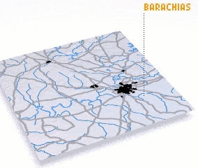 Places with similar names to Barachias, United States - USA ::
Disclaimer :: Information on this page comes without warranty of any kind |
||
|
Where is Barachias? Elevation and coordinates ::
Latitude (lat): 32°17'58"N Longitude (lon): 86°11'47"W
Elevation (approx.): 74m (map arrows pan, magnifying glasses zoom) |
||
|
Visiting Barachias? Hotel/Accommodation ::
Book a hotel in Barachias Travel Guide ::
rental cars ::
car rental offers GPS waypoint ::
download a GPX waypoint (PoI) of Barachias for your GPS receiver
|
||