|
search place name
|
||
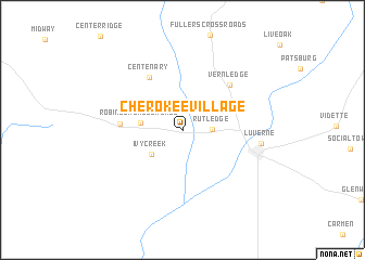
Cherokee Village (Alabama, United States - USA)Cherokee Village is a town in the Alabama region of United States - USA. An overview map of the region around Cherokee Village is displayed below.
regional and 3d topo map of Cherokee Village, United States - USA ::
Cherokee Village airports ::
The nearest airport is MXF - Montgomery Maxwell Afb, located 72.5 km north of Cherokee Village.
Other airports nearby include DHN - Dothan Rgnl (95.7 km south east), CEW - Crestview Bob Sikes (106.9 km south), VPS - Valparaiso Eglin Afb (139.3 km south), LSF - Fort Benning Lawson Aaf (143.9 km north east), Nearby towns ::
Rutledge (2.6km east) //
Ivy Creek (3.7km south west) //
Robinson Crossroads (3.7km west) //
Centenary (6.2km north west) //
Moodys Crossroads (5.5km west) //
Vernledge (6.2km north east) //
Luverne (7.1km east) //
[all distances 'as the bird flies' and approximate] 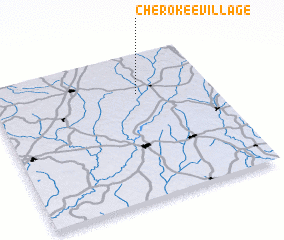 Places with similar names to Cherokee Village, United States - USA ::
// Cherokee Village (US)
// Cherokee Village (US)
Disclaimer :: Information on this page comes without warranty of any kind |
||
|
Where is Cherokee Village? Elevation and coordinates ::
Latitude (lat): 31°43'46"N Longitude (lon): 86°20'13"W
Elevation (approx.): 104m (map arrows pan, magnifying glasses zoom) |
||
|
Visiting Cherokee Village? Hotel/Accommodation ::
Book a hotel in Cherokee Village Travel Guide ::
rental cars ::
car rental offers GPS waypoint ::
download a GPX waypoint (PoI) of Cherokee Village for your GPS receiver
|
||