|
search place name
|
||
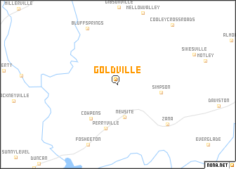
Goldville (Alabama, United States - USA)Goldville is a town in the Alabama region of United States - USA. An overview map of the region around Goldville is displayed below.
regional and 3d topo map of Goldville, United States - USA ::
Goldville airports ::
The nearest airport is ANB - Anniston Metro, located 56.4 km north of Goldville.
Other airports nearby include MXF - Montgomery Maxwell Afb (94.9 km south west), BHM - Birmingham Intl (104.8 km north west), LSF - Fort Benning Lawson Aaf (111.2 km south east), ATL - Hartsfield Jackson Atlanta Intl (140.3 km north east), Nearby towns ::
New Site (5.2km south) //
Cowpens (6.5km south west) //
Simpson (5.9km east) //
Perryville (7.1km south) //
Bluff Springs (9.8km north west) //
Zana (9.1km south east) //
[all distances 'as the bird flies' and approximate] 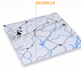 Places with similar names to Goldville, United States - USA ::
// Col di Villa (IT)
// Cale da Vila (PT)
// Gløtvola (NO)
// Coldău-Vale (RO)
// Caldevilla (ES)
// Caldevilla (ES)
// Caldevilla (ES)
// Gouldville (ZA)
// Clydevale (NZ)
// Glade Valley (US)
Disclaimer :: Information on this page comes without warranty of any kind |
||
|
Where is Goldville? Elevation and coordinates ::
Latitude (lat): 33°5'1"N Longitude (lon): 85°47'2"W
Elevation (approx.): 314m (map arrows pan, magnifying glasses zoom) |
||
|
Visiting Goldville? Hotel/Accommodation ::
Book a hotel in Goldville Travel Guide ::
rental cars ::
car rental offers GPS waypoint ::
download a GPX waypoint (PoI) of Goldville for your GPS receiver
|
||