|
search place name
|
||
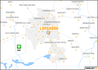
Longwood (Alabama, United States - USA)Longwood is a town in the Alabama region of United States - USA. An overview map of the region around Longwood is displayed below.
regional and 3d topo map of Longwood, United States - USA ::
Longwood airports ::
The nearest airport is HUA - Redstone Aaf, located 10.5 km south west of Longwood.
Other airports nearby include BHM - Birmingham Intl (129.2 km south), CHA - Chattanooga Lovell Fld (130.7 km east), ANB - Anniston Metro (142.1 km south east), BNA - Nashville Intl (156.2 km north), Nearby towns ::
Mayfair (0.9km south west) //
Huntsville (1.3km north) //
Echols Hill (1.5km north) //
Piedmont (2.1km south) //
Five Points (2.2km north) //
West Huntsville (2.0km west) //
Dallas (2.8km north) //
Terry Heights (2.6km north west) //
Lincoln (3.0km north) //
Darwin Downs (3.4km north east) //
Mountain Brook (3.1km east) //
Greenwycke Village (3.3km south east) //
Hillandale (3.4km north west) //
Cavalry Hill (3.6km north west) //
Chapman Heights (4.0km north) //
Fleming Meadows (4.1km south) //
Oakwood (3.9km north west) //
Huntsville Park (3.8km south west) //
Chelsea (4.1km south west) //
Oak Park (4.3km north east) //
Jones Valley Estates (4.5km south east) //
Westlawn (4.2km west) //
Shady Lane (5.5km north west) //
Flemington Heights (5.9km south) //
Davis Hills (5.9km north west) //
Fleming Hills (6.4km south) //
Parkway Estates (6.7km south) //
Edmonton Heights (6.7km north) //
Lakewood (6.8km north) //
[all distances 'as the bird flies' and approximate]  Places with similar names to Longwood, United States - USA ::
Disclaimer :: Information on this page comes without warranty of any kind |
||
|
Where is Longwood? Elevation and coordinates ::
Latitude (lat): 34°43'8"N Longitude (lon): 86°34'53"W
Elevation (approx.): 193m (map arrows pan, magnifying glasses zoom) |
||
|
Visiting Longwood? Hotel/Accommodation ::
Book a hotel in Longwood Travel Guide ::
rental cars ::
car rental offers GPS waypoint ::
download a GPX waypoint (PoI) of Longwood for your GPS receiver
|
||