|
search place name
|
||
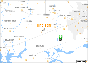
Madison (Alabama, United States - USA)Madison is a town in the Alabama region of United States - USA. An overview map of the region around Madison is displayed below.
regional and 3d topo map of Madison, United States - USA ::
Madison airports ::
The nearest airport is HUA - Redstone Aaf, located 6.3 km east of Madison.
Other airports nearby include BHM - Birmingham Intl (126.0 km south), CHA - Chattanooga Lovell Fld (146.1 km east), ANB - Anniston Metro (148.1 km south east), BNA - Nashville Intl (158.3 km north), Nearby towns ::
Maplewood (0.9km west) //
Clift Acres (1.1km north east) //
Nolan Hills (2.5km north east) //
Skyline Acres (4.2km north east) //
Rainbow (6.0km north) //
Burgreen Gin (5.5km north west) //
Rainbow Mountain Heights (6.2km north east) //
Oakland (6.3km north west) //
New Haven (7.4km south) //
Parker (6.4km west) //
Elko (7.1km east) //
Vaughn Corners (8.7km north) //
Old Monrovia (8.7km north east) //
Capshaw (9.2km north west) //
Rideout Village (9.2km north east) //
[all distances 'as the bird flies' and approximate]  Places with similar names to Madison, United States - USA ::
Disclaimer :: Information on this page comes without warranty of any kind |
||
|
Where is Madison? Elevation and coordinates ::
Latitude (lat): 34°41'57"N Longitude (lon): 86°44'54"W
Elevation (approx.): 216m (map arrows pan, magnifying glasses zoom) |
||
|
Visiting Madison? Hotel/Accommodation ::
Book a hotel in Madison Travel Guide ::
rental cars ::
car rental offers GPS waypoint ::
download a GPX waypoint (PoI) of Madison for your GPS receiver
|
||