|
search place name
|
||
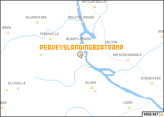
Peaveys Landing Boat Ramp (Alabama, United States - USA)Peaveys Landing Boat Ramp is a town in the Alabama region of United States - USA. An overview map of the region around Peaveys Landing Boat Ramp is displayed below.
regional and 3d topo map of Peaveys Landing Boat Ramp, United States - USA ::
Peaveys Landing Boat Ramp airports ::
The nearest airport is MOB - Mobile Rgnl, located 102.6 km south of Peaveys Landing Boat Ramp.
Other airports nearby include BFM - Mobile Downtown (108.6 km south), NMM - Meridian Nas (114.1 km north west), PNS - Pensacola Rgnl (151.9 km south east), BIX - Biloxi Keesler Afb (155.1 km south west), Nearby towns ::
Ballfield Landing (1.0km north east) //
Oil Well Landing (2.4km south east) //
Blount Landing (3.4km north) //
Wilson (6.9km south) //
Salitpa (6.4km north east) //
Saint Stephens (7.7km south) //
Baileys Landing (8.4km north) //
Frankville (7.7km north west) //
[all distances 'as the bird flies' and approximate] 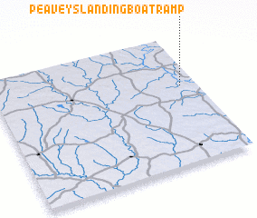 Places with similar names to Peaveys Landing Boat Ramp, United States - USA :: Disclaimer :: Information on this page comes without warranty of any kind |
||
|
Where is Peaveys Landing Boat Ramp? Elevation and coordinates ::
Latitude (lat): 31°36'21"N Longitude (lon): 88°4'54"W
Elevation (approx.): 17m (map arrows pan, magnifying glasses zoom) |
||
|
Visiting Peaveys Landing Boat Ramp? Hotel/Accommodation ::
Book a hotel in Peaveys Landing Boat Ramp Travel Guide ::
rental cars ::
car rental offers GPS waypoint ::
download a GPX waypoint (PoI) of Peaveys Landing Boat Ramp for your GPS receiver
|
||