|
search place name
|
||
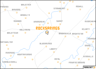
Rock Springs (Alabama, United States - USA)Rock Springs is a town in the Alabama region of United States - USA. An overview map of the region around Rock Springs is displayed below.
regional and 3d topo map of Rock Springs, United States - USA ::
Rock Springs airports ::
The nearest airport is HUA - Redstone Aaf, located 58.3 km north of Rock Springs.
Other airports nearby include BHM - Birmingham Intl (70.1 km south), ANB - Anniston Metro (89.9 km south east), CHA - Chattanooga Lovell Fld (155.6 km north east), CBM - Colombus Columbus Afb (185.7 km west), Nearby towns ::
Roswell (4.4km north) //
Blue Springs (4.7km south) //
Union Grove (4.7km north west) //
Summit (5.6km north east) //
Brooksville (5.7km east) //
Liberty (7.0km south) //
New Harmony (8.3km north) //
Holly Pond (7.4km west) //
Brooklyn (9.7km north west) //
[all distances 'as the bird flies' and approximate] 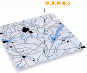 Places with similar names to Rock Springs, United States - USA ::
// Rock Springs (US)
// Rock Springs (US)
// Rock Springs (US)
// Rocky Springs (US)
// Rock Springs (US)
// Rock Springs (US)
// Rock Springs (US)
// Rock Springs (US)
// Rocksprings (US)
// Rock Springs (US)
Disclaimer :: Information on this page comes without warranty of any kind |
||
|
Where is Rock Springs? Elevation and coordinates ::
Latitude (lat): 34°10'5"N Longitude (lon): 86°32'12"W
Elevation (approx.): 251m (map arrows pan, magnifying glasses zoom) |
||
|
Visiting Rock Springs? Hotel/Accommodation ::
Book a hotel in Rock Springs Travel Guide ::
rental cars ::
car rental offers GPS waypoint ::
download a GPX waypoint (PoI) of Rock Springs for your GPS receiver
|
||