|
search place name
|
||
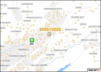
Shadywood (Alabama, United States - USA)Shadywood is a town in the Alabama region of United States - USA. An overview map of the region around Shadywood is displayed below.
regional and 3d topo map of Shadywood, United States - USA ::
Shadywood airports ::
The nearest airport is BHM - Birmingham Intl, located 6.0 km west of Shadywood.
Other airports nearby include ANB - Anniston Metro (77.4 km east), HUA - Redstone Aaf (122.2 km north), MXF - Montgomery Maxwell Afb (135.9 km south), CBM - Colombus Columbus Afb (162.8 km west), Nearby towns ::
Oakville (0.7km south west) //
Biscayne Highlands (0.9km north) //
Roebuck Forest (1.2km north east) //
Roebuck Springs (1.1km west) //
Brookhurst (1.3km north) //
Roebuck (1.2km north west) //
Barnisdale Forest (1.9km north east) //
Roebuck Crest Estates (2.3km north west) //
Huffman (2.4km north) //
South Highlands (2.2km south west) //
Roebuck Park (3.1km north) //
Magnolia Courts (3.1km north) //
Lakewood (2.9km south west) //
Woodcrest (3.0km north west) //
Ruffner (3.3km south) //
Bel Air (2.9km west) //
Roebuck Terrace (2.9km west) //
Huffman Gardens (3.3km north east) //
Nelson Heights (3.3km north west) //
Norris Junction (3.5km south east) //
Roebuck Plaza (3.1km east) //
Central Highlands (3.4km south west) //
Roebuck Gardens (3.7km north) //
Cloverdale (3.6km north west) //
East Lake (3.3km west) //
Weems (3.6km south east) //
Zion City (3.6km west) //
Killough Springs (4.2km north) //
Liberty Highlands (3.7km south east) //
[all distances 'as the bird flies' and approximate] 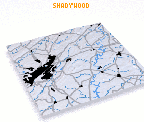 Places with similar names to Shadywood, United States - USA ::
Disclaimer :: Information on this page comes without warranty of any kind |
||
|
Where is Shadywood? Elevation and coordinates ::
Latitude (lat): 33°34'38"N Longitude (lon): 86°41'30"W
Elevation (approx.): 281m (map arrows pan, magnifying glasses zoom) |
||
|
Visiting Shadywood? Hotel/Accommodation ::
Book a hotel in Shadywood Travel Guide ::
rental cars ::
car rental offers GPS waypoint ::
download a GPX waypoint (PoI) of Shadywood for your GPS receiver
|
||