|
search place name
|
||
Weiss Dam (Alabama, United States - USA)Weiss Dam is a town in the Alabama region of United States - USA. An overview map of the region around Weiss Dam is displayed below.
regional and 3d topo map of Weiss Dam, United States - USA ::

Weiss Dam airports ::
The nearest airport is ANB - Anniston Metro, located 65.9 km south of Weiss Dam.
Other airports nearby include HUA - Redstone Aaf (103.2 km north west), CHA - Chattanooga Lovell Fld (107.5 km north east), BHM - Birmingham Intl (115.6 km south west), MGE - Marietta Dobbins Arb (Atlanta Nas) (116.7 km east), Nearby towns ::
McGhee (1.1km south east) //
Leesburg (1.9km west) //
Richardson (2.9km north) //
Bay Springs (2.4km east) //
Hopewell (3.2km north) //
Ewing (3.8km north west) //
Elrath (4.0km south) //
Dixon Shop (4.2km south west) //
Aubrey Isle (3.9km south west) //
Bristow (4.1km north west) //
Mackey (4.5km west) //
Billy Goat Hill (4.8km north east) //
Maple Grove (6.5km south west) //
Plano (6.8km south) //
Blue Pond (7.2km north) //
Centre (6.3km south east) //
Round Mountain (7.0km north east) //
Sand Rock (8.0km north) //
Tennala (10.5km south east) //
[all distances 'as the bird flies' and approximate] 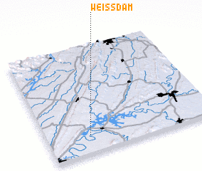 Places with similar names to Weiss Dam, United States - USA ::
// Westma (US)
// Westum (DE)
// Wisdom (US)
// Wisdom (US)
// Wisdom (US)
// West Amboy (US)
// Westum (DE)
// Wistʼ Āmba (ET)
Disclaimer :: Information on this page comes without warranty of any kind |
||
|
Where is Weiss Dam? Elevation and coordinates ::
Latitude (lat): 34°10'28"N Longitude (lon): 85°44'30"W
Elevation (approx.): 165m (map arrows pan, magnifying glasses zoom) |
||
|
Visiting Weiss Dam? Hotel/Accommodation ::
Book a hotel in Weiss Dam Travel Guide ::
rental cars ::
car rental offers GPS waypoint ::
download a GPX waypoint (PoI) of Weiss Dam for your GPS receiver
|
||