|
search place name
|
||
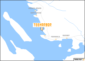
Tee Harbor (Alaska, United States - USA)Tee Harbor is a town in the Alaska region of United States - USA. An overview map of the region around Tee Harbor is displayed below.
regional and 3d topo map of Tee Harbor, United States - USA ::
Tee Harbor airports ::
The nearest airport is JNU - Juneau Intl, located 12.3 km south east of Tee Harbor.
Other airports nearby include SIT - Sitka Rocky Gutierrez (156.3 km south), Nearby towns ::
Tee Harbor (0.2km south) //
Lena Beach (2.2km south) //
Fairhaven (4.9km south east) //
Saint Terese (6.8km north) //
Dobson Landing (8.8km north) //
[all distances 'as the bird flies' and approximate]  Places with similar names to Tee Harbor, United States - USA ::
// Tee Harbor (US)
Disclaimer :: Information on this page comes without warranty of any kind |
||
|
Where is Tee Harbor? Elevation and coordinates ::
Latitude (lat): 58°24'45"N Longitude (lon): 134°45'21"W
Elevation (approx.): 82m (map arrows pan, magnifying glasses zoom) |
||
|
Visiting Tee Harbor? Hotel/Accommodation ::
Book a hotel in Tee Harbor Travel Guide ::
rental cars ::
car rental offers GPS waypoint ::
download a GPX waypoint (PoI) of Tee Harbor for your GPS receiver
|
||