|
search place name
|
||
College Park (Arizona, United States - USA)College Park is a town in the Arizona region of United States - USA. An overview map of the region around College Park is displayed below.
regional and 3d topo map of College Park, United States - USA ::

College Park airports ::
The nearest airport is LUF - Phoenix Luke Afb, located 21.6 km south west of College Park.
Other airports nearby include PHX - Phoenix Sky Harbor Intl (26.4 km south east), PRC - Prescott Ernest A Love Fld (116.1 km north), DMA - Tucson Davis Monthan Afb (202.3 km south east), TUS - Tucson Intl (203.7 km south east), Nearby towns ::
Shadow Hills (0.4km north) //
Pioneer Estates (1.3km north east) //
San Miguel (1.5km south west) //
Chaparral (1.8km north) //
Saddlehorn Ranch (1.8km north west) //
Thunderbird Palms II (2.1km south) //
Royal Estates West (2.4km south west) //
Sunset Vista (2.5km north west) //
Lexington Place (2.3km north west) //
Westcliff Park (2.7km south east) //
Dunhill Place (2.9km north east) //
Verde Real (2.7km east) //
Cactus Gale V (3.3km south) //
Parkview North (2.9km east) //
Westerra (3.4km south) //
Woodridge VI (3.5km north) //
San Gabriel (3.3km north east) //
Marlborough Meadows (3.7km south) //
Overland Trail (3.5km north east) //
Longhorn Ranch II (3.5km south west) //
Westwind (3.7km south west) //
Autumn Ridge (3.6km north east) //
Montara (3.9km south) //
Desert Pines (3.4km east) //
Canyon View (3.9km north east) //
Brandywine (3.7km east) //
Bristol Square (4.3km south) //
Weedville (3.7km south west) //
Wellington Court (4.3km south west) //
[all distances 'as the bird flies' and approximate] 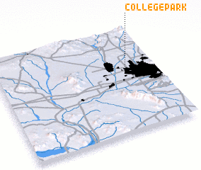 Places with similar names to College Park, United States - USA ::
// College Park (US)
// College Park (US)
// College Park (US)
// College Park (US)
// College Park (US)
// College Park (US)
// College Park (US)
// College Park (US)
// College Park (US)
// College Park (US)
Disclaimer :: Information on this page comes without warranty of any kind |
||
|
Where is College Park? Elevation and coordinates ::
Latitude (lat): 33°37'39"N Longitude (lon): 112°10'40"W
Elevation (approx.): 379m (map arrows pan, magnifying glasses zoom) |
||
|
Visiting College Park? Hotel/Accommodation ::
Book a hotel in College Park Travel Guide ::
rental cars ::
car rental offers GPS waypoint ::
download a GPX waypoint (PoI) of College Park for your GPS receiver
|
||