|
search place name
|
||
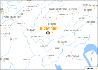
Birdsong (Arkansas, United States - USA)Birdsong is a town in the Arkansas region of United States - USA. An overview map of the region around Birdsong is displayed below.
regional and 3d topo map of Birdsong, United States - USA ::
Birdsong airports ::
The nearest airport is NQA - Millington Rgnl Jetport, located 37.4 km east of Birdsong.
Other airports nearby include MEM - Memphis Intl (53.0 km south east), JBR - Jonesboro Muni (54.1 km north west), BYH - Blytheville Arkansas Intl (63.1 km north east), MKL - Jackson Mc Kellar Sipes Rgnl (123.2 km east), Nearby towns ::
Dimple (1.6km north east) //
Denwood (3.5km north) //
Deckerville (4.1km west) //
Gilmore (5.4km south) //
Whitton (5.9km north) //
Meneshea (5.6km south east) //
Beasley (5.6km west) //
Stacy (6.6km south east) //
Chelford (6.9km north) //
Turrell (8.8km south) //
Westover (8.3km north east) //
Muir (10.9km north east) //
Wilbeth (11.0km north west) //
[all distances 'as the bird flies' and approximate] 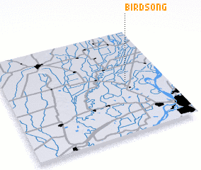 Places with similar names to Birdsong, United States - USA ::
Disclaimer :: Information on this page comes without warranty of any kind |
||
|
Where is Birdsong? Elevation and coordinates ::
Latitude (lat): 35°27'30"N Longitude (lon): 90°15'45"W
Elevation (approx.): 67m (map arrows pan, magnifying glasses zoom) |
||
|
Visiting Birdsong? Hotel/Accommodation ::
Book a hotel in Birdsong Travel Guide ::
rental cars ::
car rental offers GPS waypoint ::
download a GPX waypoint (PoI) of Birdsong for your GPS receiver
|
||