|
search place name
|
||
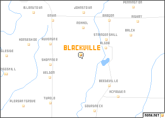
Blackville (Arkansas, United States - USA)Blackville is a town in the Arkansas region of United States - USA. An overview map of the region around Blackville is displayed below.
regional and 3d topo map of Blackville, United States - USA ::
Blackville airports ::
The nearest airport is JBR - Jonesboro Muni, located 60.8 km north east of Blackville.
Other airports nearby include LRF - Jacksonville Little Rock Afb (109.5 km south west), NQA - Millington Rgnl Jetport (118.4 km east), MEM - Memphis Intl (118.7 km south east), BYH - Blytheville Arkansas Intl (122.7 km north east), Nearby towns ::
Algoa (5.0km north east) //
Stringers Mill (6.2km north east) //
Remmel (7.1km north) //
Shoffner (6.1km west) //
Auvergne (6.8km north west) //
Weldon (7.4km south west) //
Beedeville (7.8km south east) //
Amagon (10.0km north east) //
Erwin (10.3km north west) //
McFadden (10.8km south east) //
[all distances 'as the bird flies' and approximate] 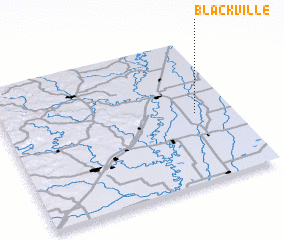 Places with similar names to Blackville, United States - USA ::
// Blackville (US)
// Belcoville (US)
// Blockville (US)
// Blackville (US)
// Blakeville (US)
// Balakéfolo (GN)
// Blackville (CA)
// Blackville (AU)
// Blakeville (AU)
Disclaimer :: Information on this page comes without warranty of any kind |
||
|
Where is Blackville? Elevation and coordinates ::
Latitude (lat): 35°29'0"N Longitude (lon): 91°9'53"W
Elevation (approx.): 69m (map arrows pan, magnifying glasses zoom) |
||
|
Visiting Blackville? Hotel/Accommodation ::
Book a hotel in Blackville Travel Guide ::
rental cars ::
car rental offers GPS waypoint ::
download a GPX waypoint (PoI) of Blackville for your GPS receiver
|
||