|
search place name
|
||
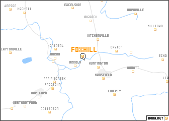
Fox Hill (Arkansas, United States - USA)Fox Hill is a town in the Arkansas region of United States - USA. An overview map of the region around Fox Hill is displayed below.
regional and 3d topo map of Fox Hill, United States - USA ::
Fox Hill airports ::
The nearest airport is FSM - Fort Smith Rgnl, located 27.6 km north of Fox Hill.
Other airports nearby include FYV - Fayetteville Drake Fld (101.5 km north), MLC - Mcalester Mc Alester Rgnl (138.3 km west), HRO - Harrison Boone Co (165.3 km north east), TXK - Texarkana Rgnl Webb Fld (184.2 km south), Nearby towns ::
Arkola (2.0km south west) //
Huntington (3.0km south east) //
Witcherville (5.2km north east) //
Mansfield (5.4km south east) //
Burna (5.3km west) //
Montreal (5.7km north west) //
Midland (5.6km west) //
Dayton (6.2km east) //
Prairie Creek (7.2km south west) //
Big Rock (8.8km north) //
Frog Town (8.5km south west) //
Liberty (9.4km south east) //
[all distances 'as the bird flies' and approximate]  Places with similar names to Fox Hill, United States - USA ::
// Vako-Zhile (RU)
// Fox Hill (US)
// Fox Hollow (US)
// Fox Hollow (US)
// Fox Hall (US)
// Fox Hollow (US)
// Foxhall (US)
// Fox Hollow (US)
// Fox Hollow (US)
// Foxhall (US)
Disclaimer :: Information on this page comes without warranty of any kind |
||
|
Where is Fox Hill? Elevation and coordinates ::
Latitude (lat): 35°5'45"N Longitude (lon): 94°17'28"W
Elevation (approx.): 189m (map arrows pan, magnifying glasses zoom) |
||
|
Visiting Fox Hill? Hotel/Accommodation ::
Book a hotel in Fox Hill Travel Guide ::
rental cars ::
car rental offers GPS waypoint ::
download a GPX waypoint (PoI) of Fox Hill for your GPS receiver
|
||