|
search place name
|
||
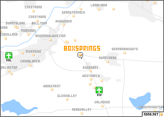
Box Springs (California, United States - USA)Box Springs is a town in the California region of United States - USA. An overview map of the region around Box Springs is displayed below.
regional and 3d topo map of Box Springs, United States - USA ::
Box Springs airports ::
The nearest airport is RIV - Riverside March Arb, located 8.0 km south east of Box Springs.
Other airports nearby include RAL - Riverside Muni (13.8 km west), ONT - Ontario Intl (30.7 km north west), SNA - Santa Ana John Wayne Arpt Orange Co (60.9 km south west), PSP - Palm Springs Intl (74.1 km east), Nearby towns ::
Edgemont (3.4km south east) //
Belvedere Heights (4.3km north) //
Lemona (4.6km north west) //
Canyon Crest Heights (4.8km north west) //
West March (5.1km south) //
Sunnymead (4.9km east) //
Arnold Heights (6.1km south) //
March Field (6.4km south east) //
Alessandro (7.2km south) //
Riverside Junction (7.4km north west) //
Highgrove (8.4km north west) //
Woodcrest (9.1km south west) //
[all distances 'as the bird flies' and approximate] 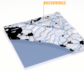 Places with similar names to Box Springs, United States - USA ::
// Box Springs (US)
// Box Springs (US)
Disclaimer :: Information on this page comes without warranty of any kind |
||
|
Where is Box Springs? Elevation and coordinates ::
Latitude (lat): 33°56'48"N Longitude (lon): 117°17'44"W
Elevation (approx.): 463m (map arrows pan, magnifying glasses zoom) |
||
|
Visiting Box Springs? Hotel/Accommodation ::
Book a hotel in Box Springs Travel Guide ::
rental cars ::
car rental offers GPS waypoint ::
download a GPX waypoint (PoI) of Box Springs for your GPS receiver
|
||