|
search place name
|
||
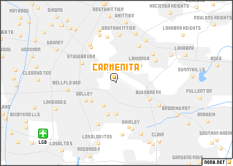
Carmenita (California, United States - USA)Carmenita is a town in the California region of United States - USA. An overview map of the region around Carmenita is displayed below.
regional and 3d topo map of Carmenita, United States - USA ::
Carmenita airports ::
The nearest airport is LGB - Long Beach, located 12.8 km south west of Carmenita.
Other airports nearby include HHR - Jack Northrop Fld Hawthorne Muni (27.0 km west), SNA - Santa Ana John Wayne Arpt Orange Co (29.0 km south east), LAX - Los Angeles Intl (34.0 km west), BUR - Burbank Bob Hope (44.9 km north west), Nearby towns ::
Cerritos (4.1km south west) //
La Mirada (4.3km north east) //
Artesia (4.4km south west) //
La Palma (5.0km south) //
Bingham (5.2km south) //
Dolley (5.1km south west) //
Buena Park (5.2km south east) //
Studebaker (5.6km north west) //
Colima (6.6km north east) //
Fulton Wells (6.6km north west) //
Hawaiian Gardens (7.1km south) //
East La Mirada (6.4km north east) //
Halcon (7.3km south) //
Leffingwell (6.8km north east) //
Valla (7.5km north) //
Santa Fe Springs (7.2km north west) //
Almond (6.7km south east) //
South Whittier (7.7km north) //
Shirley (7.7km south) //
Bellflower (6.6km west) //
Los Nietos Junction (8.1km north) //
Cypress (8.3km south) //
Friendly Hills (8.0km north east) //
East Whittier (8.4km north) //
Los Nietos (8.8km north) //
Hansen (8.9km south) //
Des Moines (8.5km north east) //
Downey Road (10.2km north west) //
McCampbell (10.8km north west) //
[all distances 'as the bird flies' and approximate]  Places with similar names to Carmenita, United States - USA ::
// Graymont (US)
// Graymont (US)
// Graymont (US)
// Körmend (HU)
// Garmendía (CU)
// Kremeni Do (BA)
// Kremeni Do (BA)
// Gura Menţii (RO)
// Carmonita (ES)
// Garmanda (RU)
Disclaimer :: Information on this page comes without warranty of any kind |
||
|
Where is Carmenita? Elevation and coordinates ::
Latitude (lat): 33°53'29"N Longitude (lon): 118°2'43"W
Elevation (approx.): 26m (map arrows pan, magnifying glasses zoom) |
||
|
Visiting Carmenita? Hotel/Accommodation ::
Book a hotel in Carmenita Travel Guide ::
rental cars ::
car rental offers GPS waypoint ::
download a GPX waypoint (PoI) of Carmenita for your GPS receiver
|
||