|
search place name
|
||
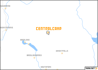
Central Camp (California, United States - USA)Central Camp is a town in the California region of United States - USA. An overview map of the region around Central Camp is displayed below.
regional and 3d topo map of Central Camp, United States - USA ::
Central Camp airports ::
The nearest airport is FAT - Fresno Yosemite Intl, located 67.0 km south of Central Camp.
Other airports nearby include MER - Merced Castle (96.2 km west), MOD - Modesto City Co Harry Sham (133.7 km west), SCK - Stockton Metropolitan (166.4 km west), RIU - Rancho Murieta (190.3 km north west), Nearby towns ::
The Pines (7.0km south west) //
Whisky Falls (8.0km south east) //
Bass Lake Annex (9.8km south west) //
[all distances 'as the bird flies' and approximate] 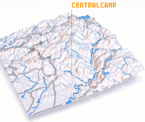 Places with similar names to Central Camp, United States - USA :: Disclaimer :: Information on this page comes without warranty of any kind |
||
|
Where is Central Camp? Elevation and coordinates ::
Latitude (lat): 37°20'58"N Longitude (lon): 119°28'58"W
Elevation (approx.): 1660m (map arrows pan, magnifying glasses zoom) |
||
|
Visiting Central Camp? Hotel/Accommodation ::
Book a hotel in Central Camp Travel Guide ::
rental cars ::
car rental offers GPS waypoint ::
download a GPX waypoint (PoI) of Central Camp for your GPS receiver
|
||