|
search place name
|
||
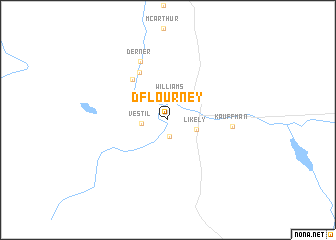
D Flourney (California, United States - USA)D Flourney is a town in the California region of United States - USA. An overview map of the region around D Flourney is displayed below.
regional and 3d topo map of D Flourney, United States - USA ::
D Flourney airports ::
The nearest airport is RNO - Reno Tahoe Intl, located 203.9 km south of D Flourney.
Other airports nearby include NFL - Fallon Nas (255.3 km south east), Nearby towns ::
K Flourney (1.9km south) //
Williams (2.6km north) //
Vestil (2.3km west) //
Likely (2.6km south east) //
Christensen (5.5km north west) //
McGarva (5.9km north west) //
Kauffman (5.5km east) //
Derner (7.0km north) //
[all distances 'as the bird flies' and approximate] 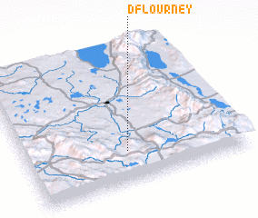 Places with similar names to D Flourney, United States - USA :: Disclaimer :: Information on this page comes without warranty of any kind |
||
|
Where is D Flourney? Elevation and coordinates ::
Latitude (lat): 41°14'24"N Longitude (lon): 120°31'53"W
Elevation (approx.): 1342m (map arrows pan, magnifying glasses zoom) |
||
|
Visiting D Flourney? Hotel/Accommodation ::
Book a hotel in D Flourney Travel Guide ::
rental cars ::
car rental offers GPS waypoint ::
download a GPX waypoint (PoI) of D Flourney for your GPS receiver
|
||