|
search place name
|
||
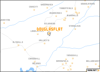
Douglas Flat (California, United States - USA)Douglas Flat is a town in the California region of United States - USA. An overview map of the region around Douglas Flat is displayed below.
regional and 3d topo map of Douglas Flat, United States - USA ::
Douglas Flat airports ::
The nearest airport is MOD - Modesto City Co Harry Sham, located 69.9 km south west of Douglas Flat.
Other airports nearby include RIU - Rancho Murieta (70.2 km north west), SCK - Stockton Metropolitan (73.1 km west), MER - Merced Castle (82.1 km south), SAC - Sacramento Executive (101.1 km north west), Nearby towns ::
Vallecito (3.1km south west) //
Wyldewood (3.5km north) //
Big Valley (3.1km north east) //
Rocky Hill (3.6km north) //
La Honda Park (3.7km west) //
Indian Creek (7.7km north) //
Cedar Vista (7.4km north east) //
Forest Meadows (7.4km north east) //
Hanford Hill (8.0km north east) //
Columbia (9.9km south east) //
Indian Hills (9.4km north east) //
Yankee Hill (10.7km south east) //
[all distances 'as the bird flies' and approximate] 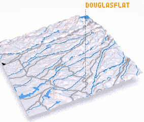 Places with similar names to Douglas Flat, United States - USA :: Disclaimer :: Information on this page comes without warranty of any kind |
||
|
Where is Douglas Flat? Elevation and coordinates ::
Latitude (lat): 38°6'52"N Longitude (lon): 120°27'14"W
Elevation (approx.): 601m (map arrows pan, magnifying glasses zoom) |
||
|
Visiting Douglas Flat? Hotel/Accommodation ::
Book a hotel in Douglas Flat Travel Guide ::
rental cars ::
car rental offers GPS waypoint ::
download a GPX waypoint (PoI) of Douglas Flat for your GPS receiver
|
||