|
search place name
|
||
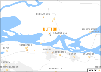
Dutton (California, United States - USA)Dutton is a town in the California region of United States - USA. An overview map of the region around Dutton is displayed below.
regional and 3d topo map of Dutton, United States - USA ::
Dutton airports ::
The nearest airport is SUU - Fairfield Travis Afb, located 21.1 km north of Dutton.
Other airports nearby include OAK - Metropolitan Oakland Intl (49.4 km south west), SAC - Sacramento Executive (59.2 km north east), SCK - Stockton Metropolitan (60.1 km east), SFO - San Francisco Intl (66.7 km south west), Nearby towns ::
Spoonbill (2.5km south west) //
Collinsville (2.9km east) //
Chipps (3.9km south west) //
Molena (5.6km north) //
Diamond (6.1km south) //
Cornwall (6.2km south) //
Birds Landing (6.4km north) //
Meins Landing (7.4km north) //
Los Medanos (7.6km south) //
West Pittsburg (7.2km south west) //
McAvoy (7.9km south west) //
Bay Point (8.6km south west) //
Antioch (10.4km south east) //
[all distances 'as the bird flies' and approximate]  Places with similar names to Dutton, United States - USA ::
Disclaimer :: Information on this page comes without warranty of any kind |
||
|
Where is Dutton? Elevation and coordinates ::
Latitude (lat): 38°4'34"N Longitude (lon): 121°52'56"W
Elevation (approx.): 3m (map arrows pan, magnifying glasses zoom) |
||
|
Visiting Dutton? Hotel/Accommodation ::
Book a hotel in Dutton Travel Guide ::
rental cars ::
car rental offers GPS waypoint ::
download a GPX waypoint (PoI) of Dutton for your GPS receiver
|
||