|
search place name
|
||
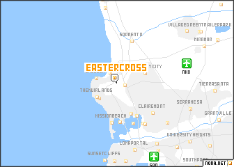
Easter Cross (California, United States - USA)Easter Cross is a town in the California region of United States - USA. An overview map of the region around Easter Cross is displayed below.
regional and 3d topo map of Easter Cross, United States - USA ::
nearby GPS traces from timatio ::
Easter Cross airports ::
The nearest airport is NKX - Miramar Mcas, located 10.0 km east of Easter Cross.
Other airports nearby include SAN - San Diego Intl (12.8 km south east), NZY - San Diego North Island Nas (15.8 km south), TIJ - Tijuana General Abelardo L Rodriguez Intl (41.9 km south east), SNA - Santa Ana John Wayne Arpt Orange Co (109.5 km north west), Nearby towns ::
Elvira (1.1km east) //
La Jolla Shores (2.0km north west) //
La Jolla (2.9km west) //
La Jolla Hermosa (3.4km south west) //
The Muirlands (3.5km south west) //
University City (4.1km north east) //
Campland on the Bay Trailer Park (5.2km south) //
De Anza Trailer Harbor (5.8km south east) //
Riviera Shores (6.2km south) //
Mission Beach (6.4km south) //
Fiesta Shores (6.8km south) //
Sorrento (7.1km north) //
Clairemont (6.8km south east) //
Bay Park (7.4km south east) //
Bayside Village (7.5km south east) //
Linda Vista (9.3km south east) //
[all distances 'as the bird flies' and approximate] 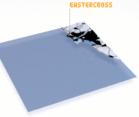 Places with similar names to Easter Cross, United States - USA :: Disclaimer :: Information on this page comes without warranty of any kind |
||
|
Where is Easter Cross? Elevation and coordinates ::
Latitude (lat): 32°50'23"N Longitude (lon): 117°14'37"W
Elevation (approx.): 214m (map arrows pan, magnifying glasses zoom) |
||
|
Visiting Easter Cross? Hotel/Accommodation ::
Book a hotel in Easter Cross Travel Guide ::
rental cars ::
car rental offers GPS waypoint ::
download a GPX waypoint (PoI) of Easter Cross for your GPS receiver
|
||