|
search place name
|
||
El Merrie Dell (California, United States - USA)El Merrie Dell is a town in the California region of United States - USA. An overview map of the region around El Merrie Dell is displayed below.
regional and 3d topo map of El Merrie Dell, United States - USA ::
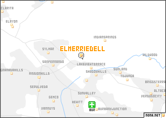
El Merrie Dell airports ::
The nearest airport is BUR - Burbank Bob Hope, located 10.6 km south of El Merrie Dell.
Other airports nearby include LAX - Los Angeles Intl (39.2 km south), HHR - Jack Northrop Fld Hawthorne Muni (41.5 km south), PMD - Palmdale Rgnl Usaf Plt 42 (45.8 km north east), LGB - Long Beach (56.9 km south), Nearby towns ::
Lake View Terrace (2.6km south east) //
Shadow Hills (4.5km south east) //
Stonehurst (5.0km south) //
Indian Springs (5.8km north east) //
San Fernando (5.7km west) //
Sylmar (6.6km west) //
Sun Valley (8.7km south) //
Sunland (7.7km south east) //
[all distances 'as the bird flies' and approximate] 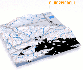 Places with similar names to El Merrie Dell, United States - USA ::
// El Martillo (CU)
// El Martillo (CU)
// El Martillo (CU)
// El Martillo (CU)
// El Martillo (CU)
// El Martillo (US)
// El Martillo (CO)
// El Martillo (SV)
// El Marital (VE)
// El Martillo (VE)
Disclaimer :: Information on this page comes without warranty of any kind |
||
|
Where is El Merrie Dell? Elevation and coordinates ::
Latitude (lat): 34°17'43"N Longitude (lon): 118°22'40"W
Elevation (approx.): 436m (map arrows pan, magnifying glasses zoom) |
||
|
Visiting El Merrie Dell? Hotel/Accommodation ::
Book a hotel in El Merrie Dell Travel Guide ::
rental cars ::
car rental offers GPS waypoint ::
download a GPX waypoint (PoI) of El Merrie Dell for your GPS receiver
|
||