|
search place name
|
||
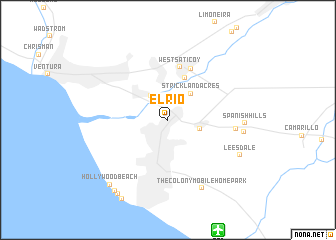
El Rio (California, United States - USA)El Rio is a town in the California region of United States - USA. An overview map of the region around El Rio is displayed below.
regional and 3d topo map of El Rio, United States - USA ::
El Rio airports ::
The nearest airport is NTD - Point Mugu Nas, located 13.3 km south of El Rio.
Other airports nearby include BUR - Burbank Bob Hope (75.0 km east), LAX - Los Angeles Intl (77.5 km south east), HHR - Jack Northrop Fld Hawthorne Muni (84.5 km south east), LGB - Long Beach (104.8 km south east), Nearby towns ::
Kimball (3.1km north west) //
Arts Trailer Court (3.1km east) //
Strickland Acres (3.6km north east) //
Cabrillo Village (4.9km north) //
West Saticoy (6.0km north) //
Saticoy (6.0km north) //
Casa del Norte Mobile Home Community (6.4km east) //
The Colony Mobile Home Park (8.2km south) //
Springville (7.2km east) //
Spanish Hills (7.2km east) //
Leesdale (7.8km south east) //
Hollywood Beach (9.0km south west) //
Hollywood by the Sea (9.4km south west) //
Channel Islands Beach (9.5km south west) //
Silver Strand (9.8km south west) //
[all distances 'as the bird flies' and approximate] 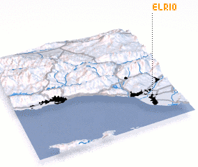 Places with similar names to El Rio, United States - USA ::
Disclaimer :: Information on this page comes without warranty of any kind |
||
|
Where is El Rio? Elevation and coordinates ::
Latitude (lat): 34°13'56"N Longitude (lon): 119°10'18"W
Elevation (approx.): 31m (map arrows pan, magnifying glasses zoom) |
||
|
Visiting El Rio? Hotel/Accommodation ::
Book a hotel in El Rio Travel Guide ::
rental cars ::
car rental offers GPS waypoint ::
download a GPX waypoint (PoI) of El Rio for your GPS receiver
|
||