|
search place name
|
||
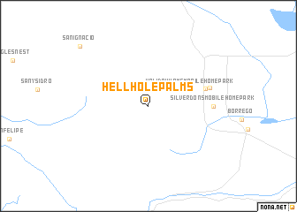
Hellhole Palms (California, United States - USA)Hellhole Palms is a town in the California region of United States - USA. An overview map of the region around Hellhole Palms is displayed below.
regional and 3d topo map of Hellhole Palms, United States - USA ::
Hellhole Palms airports ::
The nearest airport is PSP - Palm Springs Intl, located 66.1 km north of Hellhole Palms.
Other airports nearby include NKX - Miramar Mcas (77.3 km south west), NJK - El Centro Naf (84.8 km south east), SAN - San Diego Intl (89.6 km south west), TIJ - Tijuana General Abelardo L Rodriguez Intl (91.7 km south west), Nearby towns ::
Desert Sands Mobile Home Park (4.6km north east) //
Holiday Home Mobile Home Park (4.9km north east) //
Borrego Springs (6.4km east) //
El Rancho Mobile Home Park (6.9km east) //
Silver Dons Mobile Home Park (6.9km east) //
San Ignacio (10.5km north west) //
[all distances 'as the bird flies' and approximate] 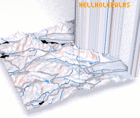 Places with similar names to Hellhole Palms, United States - USA :: Disclaimer :: Information on this page comes without warranty of any kind |
||
|
Where is Hellhole Palms? Elevation and coordinates ::
Latitude (lat): 33°14'12"N Longitude (lon): 116°26'22"W
Elevation (approx.): 525m (map arrows pan, magnifying glasses zoom) |
||
|
Visiting Hellhole Palms? Hotel/Accommodation ::
Book a hotel in Hellhole Palms Travel Guide ::
rental cars ::
car rental offers GPS waypoint ::
download a GPX waypoint (PoI) of Hellhole Palms for your GPS receiver
|
||