|
search place name
|
||
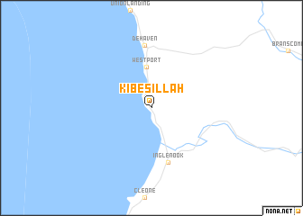
Kibesillah (California, United States - USA)Kibesillah is a town in the California region of United States - USA. An overview map of the region around Kibesillah is displayed below.
regional and 3d topo map of Kibesillah, United States - USA ::
Kibesillah airports ::
The nearest airport is SUU - Fairfield Travis Afb, located 217.8 km south east of Kibesillah.
Other airports nearby include OAK - Metropolitan Oakland Intl (247.8 km south east), SFO - San Francisco Intl (250.6 km south east), Nearby towns ::
 Places with similar names to Kibesillah, United States - USA ::
Disclaimer :: Information on this page comes without warranty of any kind |
||
|
Where is Kibesillah? Elevation and coordinates ::
Latitude (lat): 39°35'25"N Longitude (lon): 123°46'36"W
Elevation (approx.): 74m (map arrows pan, magnifying glasses zoom) |
||
|
Visiting Kibesillah? Hotel/Accommodation ::
Book a hotel in Kibesillah Travel Guide ::
rental cars ::
car rental offers GPS waypoint ::
download a GPX waypoint (PoI) of Kibesillah for your GPS receiver
|
||