|
search place name
|
||
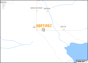
Martinez (California, United States - USA)Martinez is a town in the California region of United States - USA. An overview map of the region around Martinez is displayed below.
regional and 3d topo map of Martinez, United States - USA ::
Martinez airports ::
The nearest airport is PSP - Palm Springs Intl, located 44.2 km north west of Martinez.
Other airports nearby include NJK - El Centro Naf (92.9 km south east), RIV - Riverside March Arb (108.5 km west), CXL - Calexico Intl (115.6 km south east), NKX - Miramar Mcas (120.2 km south west), Nearby towns ::
Valerie (2.6km west) //
Mecca (7.1km east) //
Thermal (8.7km north) //
Sandy Korner (9.2km north) //
[all distances 'as the bird flies' and approximate] 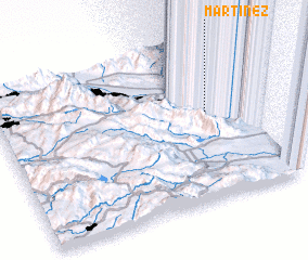 Places with similar names to Martinez, United States - USA ::
Disclaimer :: Information on this page comes without warranty of any kind |
||
|
Where is Martinez? Elevation and coordinates ::
Latitude (lat): 33°33'46"N Longitude (lon): 116°9'8"W
Elevation (approx.): -43m (map arrows pan, magnifying glasses zoom) |
||
|
Visiting Martinez? Hotel/Accommodation ::
Book a hotel in Martinez Travel Guide ::
rental cars ::
car rental offers GPS waypoint ::
download a GPX waypoint (PoI) of Martinez for your GPS receiver
|
||