|
search place name
|
||
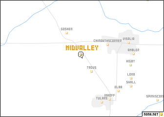
Midvalley (California, United States - USA)Midvalley is a town in the California region of United States - USA. An overview map of the region around Midvalley is displayed below.
regional and 3d topo map of Midvalley, United States - USA ::
Midvalley airports ::
The nearest airport is FAT - Fresno Yosemite Intl, located 60.8 km north west of Midvalley.
Other airports nearby include BFL - Bakersfield Meadows Fld (100.5 km south), MER - Merced Castle (159.8 km north west), MOD - Modesto City Co Harry Sham (203.0 km north west), VBG - Lompoc Vandenberg Afb (204.4 km south west), Nearby towns ::
Tagus (3.5km south east) //
Chinowths Corner (5.7km north east) //
Goshen (6.6km north west) //
Elba (10.0km south east) //
[all distances 'as the bird flies' and approximate]  Places with similar names to Midvalley, United States - USA ::
// Meadville (US)
// Meadowvale (US)
// Mead Valley (US)
// Mid Vail (US)
// Midvale (US)
// Midville (US)
// Meadowville (US)
// Midvale (US)
// Midvale (US)
// Mettevoll (NO)
Disclaimer :: Information on this page comes without warranty of any kind |
||
|
Where is Midvalley? Elevation and coordinates ::
Latitude (lat): 36°17'53"N Longitude (lon): 119°23'14"W
Elevation (approx.): 92m (map arrows pan, magnifying glasses zoom) |
||
|
Visiting Midvalley? Hotel/Accommodation ::
Book a hotel in Midvalley Travel Guide ::
rental cars ::
car rental offers GPS waypoint ::
download a GPX waypoint (PoI) of Midvalley for your GPS receiver
|
||