|
search place name
|
||
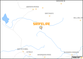
San Felipe (California, United States - USA)San Felipe is a town in the California region of United States - USA. An overview map of the region around San Felipe is displayed below.
regional and 3d topo map of San Felipe, United States - USA ::
San Felipe airports ::
The nearest airport is NKX - Miramar Mcas, located 62.7 km south west of San Felipe.
Other airports nearby include PSP - Palm Springs Intl (70.4 km north), SAN - San Diego Intl (75.7 km south west), NZY - San Diego North Island Nas (80.1 km south west), TIJ - Tijuana General Abelardo L Rodriguez Intl (80.9 km south west), Nearby towns ::
San Ysidro (6.9km north east) //
[all distances 'as the bird flies' and approximate] 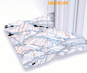 Places with similar names to San Felipe, United States - USA ::
// San Felipe (BZ)
// San Felipe (BZ)
// San Felipe (BZ)
// San Felipe (US)
// San Felipe (PA)
// San Filippo (IT)
// San Filippo (IT)
// San Filippo (IT)
// San Filippo (IT)
// San Filippo (IT)
Disclaimer :: Information on this page comes without warranty of any kind |
||
|
Where is San Felipe? Elevation and coordinates ::
Latitude (lat): 33°11'57"N Longitude (lon): 116°35'52"W
Elevation (approx.): 1079m (map arrows pan, magnifying glasses zoom) |
||
|
Visiting San Felipe? Hotel/Accommodation ::
Book a hotel in San Felipe Travel Guide ::
rental cars ::
car rental offers GPS waypoint ::
download a GPX waypoint (PoI) of San Felipe for your GPS receiver
|
||