|
search place name
|
||
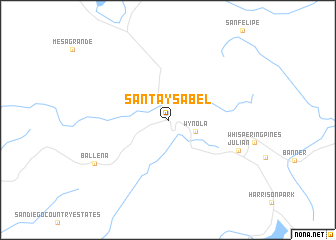
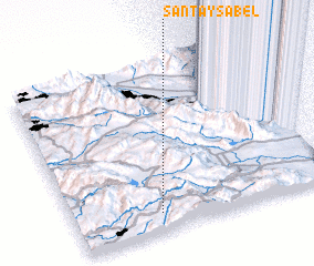
Santa Ysabel (California, United States - USA)Santa Ysabel is a town in the California region of United States - USA. An overview map of the region around Santa Ysabel is displayed below.
regional and 3d topo map of Santa Ysabel, United States - USA ::
Santa Ysabel airports ::
The nearest airport is NKX - Miramar Mcas, located 51.4 km south west of Santa Ysabel.
Other airports nearby include SAN - San Diego Intl (63.9 km south west), NZY - San Diego North Island Nas (68.2 km south west), TIJ - Tijuana General Abelardo L Rodriguez Intl (68.9 km south west), PSP - Palm Springs Intl (81.4 km north), Nearby towns ::
 Places with similar names to Santa Ysabel, United States - USA ::
// Santa Isabel (BR)
// Santa Isabel (BR)
// Santa Isabel (BR)
// Santa Isabel (BR)
// Santa Isabel (BR)
// Santa Isabel (BR)
// Santa Isabel (BR)
// Santa Isabel (BR)
// Santa Isabel (BR)
// Santa Isabel (BR)
Disclaimer :: Information on this page comes without warranty of any kind |
||
|
Where is Santa Ysabel? Elevation and coordinates ::
Latitude (lat): 33°6'33"N Longitude (lon): 116°40'20"W
Elevation (approx.): 920m (map arrows pan, magnifying glasses zoom) |
||
|
Visiting Santa Ysabel? Hotel/Accommodation ::
Book a hotel in Santa Ysabel Travel Guide ::
rental cars ::
car rental offers GPS waypoint ::
download a GPX waypoint (PoI) of Santa Ysabel for your GPS receiver
|
||