|
search place name
|
||
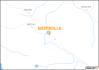
Sierraville (California, United States - USA)Sierraville is a town in the California region of United States - USA. An overview map of the region around Sierraville is displayed below.
regional and 3d topo map of Sierraville, United States - USA ::
Sierraville airports ::
The nearest airport is RNO - Reno Tahoe Intl, located 52.4 km east of Sierraville.
Other airports nearby include BAB - Marysville Beale Afb (105.1 km south west), MCC - Sacramento Mc Clellan Afld (135.9 km south west), RIU - Rancho Murieta (138.0 km south west), NFL - Fallon Nas (144.5 km east), Nearby towns ::
Campbell Hot Springs (2.3km south east) //
Sattley (5.9km north west) //
Calpine (10.5km north west) //
[all distances 'as the bird flies' and approximate] 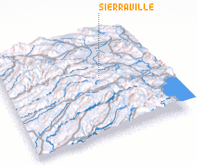 Places with similar names to Sierraville, United States - USA ::
// Şǝrǝfli (AZ)
// Sarovlu (AZ)
// São Rafael (BR)
// São Rafael (BR)
// São Rafael (BR)
// São Rafael (BR)
// São Rafael (BR)
// São Rafael (BR)
// Sarvuela (BR)
// Serravalle (IT)
Disclaimer :: Information on this page comes without warranty of any kind |
||
|
Where is Sierraville? Elevation and coordinates ::
Latitude (lat): 39°35'23"N Longitude (lon): 120°21'59"W
Elevation (approx.): 1512m (map arrows pan, magnifying glasses zoom) |
||
|
Visiting Sierraville? Hotel/Accommodation ::
Book a hotel in Sierraville Travel Guide ::
rental cars ::
car rental offers GPS waypoint ::
download a GPX waypoint (PoI) of Sierraville for your GPS receiver
|
||