|
search place name
|
||
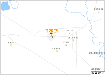
Tracy (California, United States - USA)Tracy is a town in the California region of United States - USA. An overview map of the region around Tracy is displayed below.
regional and 3d topo map of Tracy, United States - USA ::
Tracy airports ::
The nearest airport is SCK - Stockton Metropolitan, located 23.7 km north east of Tracy.
Other airports nearby include MOD - Modesto City Co Harry Sham (43.3 km east), SJC - Norman Y Mineta San Jose Intl (61.2 km south west), NUQ - Mountain View Moffett Federal Afld (65.9 km south west), OAK - Metropolitan Oakland Intl (70.2 km west), Nearby towns ::
 Places with similar names to Tracy, United States - USA ::
// Douar ez Zaouia (MA)
// Douar Zaouia (MA)
// Tarasa (RU)
// Tarasy (RU)
// Tarasy (RU)
// Tarusa (RU)
// Tarusy (RU)
// Terasy (RU)
// Torres (BO)
// Torrez (BO)
Disclaimer :: Information on this page comes without warranty of any kind |
||
|
Where is Tracy? Elevation and coordinates ::
Latitude (lat): 37°44'23"N Longitude (lon): 121°25'27"W
Elevation (approx.): 16m (map arrows pan, magnifying glasses zoom) |
||
|
Visiting Tracy? Hotel/Accommodation ::
Book a hotel in Tracy Travel Guide ::
rental cars ::
car rental offers GPS waypoint ::
download a GPX waypoint (PoI) of Tracy for your GPS receiver
|
||