|
search place name
|
||
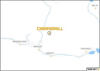
Champion Mill (Colorado, United States - USA)Champion Mill is a town in the Colorado region of United States - USA. An overview map of the region around Champion Mill is displayed below.
regional and 3d topo map of Champion Mill, United States - USA ::
Champion Mill airports ::
The nearest airport is COS - City Of Colorado Springs Muni, located 160.5 km east of Champion Mill.
Other airports nearby include BKF - Buckley Afb (163.4 km north east), DEN - Denver Intl (176.8 km north east), Nearby towns ::
 Places with similar names to Champion Mill, United States - USA :: Disclaimer :: Information on this page comes without warranty of any kind |
||
|
Where is Champion Mill? Elevation and coordinates ::
Latitude (lat): 39°8'15"N Longitude (lon): 106°30'14"W
Elevation (approx.): 3550m (map arrows pan, magnifying glasses zoom) |
||
|
Visiting Champion Mill? Hotel/Accommodation ::
Book a hotel in Champion Mill Travel Guide ::
rental cars ::
car rental offers GPS waypoint ::
download a GPX waypoint (PoI) of Champion Mill for your GPS receiver
|
||