|
search place name
|
||
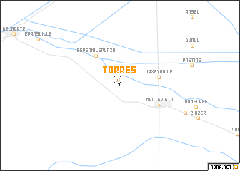
Torres (Colorado, United States - USA)Torres is a town in the Colorado region of United States - USA. An overview map of the region around Torres is displayed below.
regional and 3d topo map of Torres, United States - USA ::
Torres airports ::
The nearest airport is PUB - Pueblo Memorial Pueblo Mem, located 168.1 km north east of Torres.
Other airports nearby include COS - City Of Colorado Springs Muni (187.2 km north east), Nearby towns ::
Sevenmile Plaza (5.4km north west) //
Maxeyville (5.0km east) //
Monte Vista (5.8km south east) //
[all distances 'as the bird flies' and approximate] 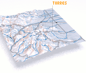 Places with similar names to Torres, United States - USA ::
// Douar ez Zaouia (MA)
// Douar Zaouia (MA)
// Tarasa (RU)
// Tarasy (RU)
// Tarasy (RU)
// Tarusa (RU)
// Tarusy (RU)
// Terasy (RU)
// Torres (BO)
// Torrez (BO)
Disclaimer :: Information on this page comes without warranty of any kind |
||
|
Where is Torres? Elevation and coordinates ::
Latitude (lat): 37°36'24"N Longitude (lon): 106°12'14"W
Elevation (approx.): 2349m (map arrows pan, magnifying glasses zoom) |
||
|
Visiting Torres? Hotel/Accommodation ::
Book a hotel in Torres Travel Guide ::
rental cars ::
car rental offers GPS waypoint ::
download a GPX waypoint (PoI) of Torres for your GPS receiver
|
||