|
search place name
|
||
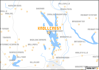
Knollcrest (Connecticut, United States - USA)Knollcrest is a town in the Connecticut region of United States - USA. An overview map of the region around Knollcrest is displayed below.
regional and 3d topo map of Knollcrest, United States - USA ::
Knollcrest airports ::
The nearest airport is BDR - Stratford Igor I Sikorsky Mem, located 46.9 km south east of Knollcrest.
Other airports nearby include HPN - White Plains Westchester Co (52.0 km south west), SWF - Newburgh Stewart Intl (53.3 km west), HFD - Hartford Brainard (73.1 km east), BDL - Windsor Locks Bradley Intl (81.5 km north east), Nearby towns ::
Candlewood Knolls (2.1km south) //
Chimney Point (2.1km east) //
Candlewood Lake Club (2.2km east) //
Candlewood Shores (2.8km south east) //
Hollywyle Park (3.9km south) //
New Fairfield (3.9km south west) //
Candlewood Orchards (4.2km south east) //
Candlewood Pines (4.8km south) //
Candlewood Point (4.7km north east) //
Margerie Manor (5.2km south) //
Bigelow Corners (4.3km south west) //
Hawthorne Terrace (5.4km south east) //
Birch Groves (5.8km north) //
Aqua Vista (6.1km south) //
Lanesville (5.5km north east) //
Snug Harbor (6.3km south) //
Brookfield (5.1km east) //
Cedar Heights (6.2km south east) //
Lattins Landing (6.3km south east) //
Ta'agan Point (6.9km south) //
Candlewood Springs (7.2km north) //
Pleasant Acres (7.7km south) //
Ball Pond (6.7km south west) //
Lakeside Woods (7.8km north) //
Wildmans Landing (8.3km south) //
Atchison Cove (8.5km north) //
Taylor Corners (7.5km south west) //
Hayestown (8.8km south) //
Brookfield Center (7.5km south east) //
[all distances 'as the bird flies' and approximate] 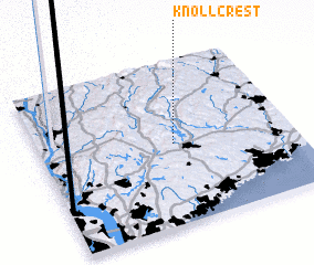 Places with similar names to Knollcrest, United States - USA ::
// Nalcrest (US)
// Knollcrest (US)
Disclaimer :: Information on this page comes without warranty of any kind |
||
|
Where is Knollcrest? Elevation and coordinates ::
Latitude (lat): 41°29'55"N Longitude (lon): 73°28'1"W
Elevation (approx.): 142m (map arrows pan, magnifying glasses zoom) |
||
|
Visiting Knollcrest? Hotel/Accommodation ::
Book a hotel in Knollcrest Travel Guide ::
rental cars ::
car rental offers GPS waypoint ::
download a GPX waypoint (PoI) of Knollcrest for your GPS receiver
|
||